IMAGE DATA PROCESSING
We can give you the following end products shown below:
True Orthomosaic
Our software will stitch together the hundreds of aerial images to compose a single image of the area under investigation. The Latitude and
Longitude of every point in the two dimensional picture will reflect closely the real position on the ground. All measurements on the computer screen are up to scale with the actual measurements at the site.

Digital Surface Model (DSM)
The model depicts the elevation of all the surfaces from a bird’s eye view by using false coloring to show the heights
of each and every surface from treetops, roof tops, grounds, pits, lake and pond surfaces, etc.

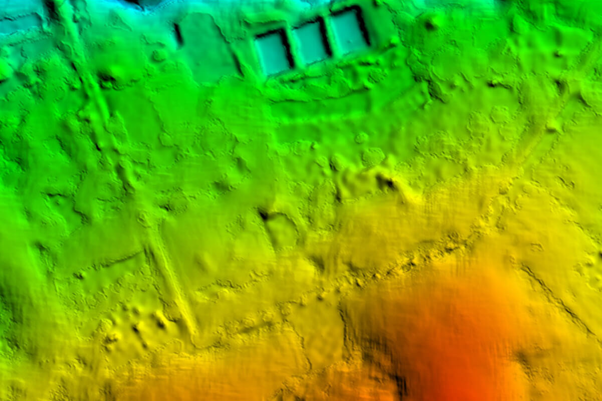
Digital Terrain Model (DTM)
The software will take away all above ground elements, whether it be building structures, trees, etc. and leave only the ground level terrain showing the false coloring of different terrain elevations. These models are very helpful in water resource management projects, soil conservation study as well as soil erosion determination.

3D-Model
The ability to reconstruct a 3D representation will help in the visualization of the whole area underinvestigation. It can also be used asinputs into other application software such as the simulation program for training rescue workers in disaster preparedness.

Normalized Difference Vegetation Index (NDVI) Map
NDVI is the term used to calculate “Plant Health”, images taken with a multi spectral camera equipped drone,once processed will generatean NDVIMap that identifies “stressed areas” within the plantationfields. This can be
due to numerous reasons such aslack of water, insufficient nutrients, plantdisease, water logging, poor irrigation,etc. Corrective actions can then betaken to remedy the particular situationand minimize the loss in yield. Thisconstitutes what is today known as “Precision Agriculture”.

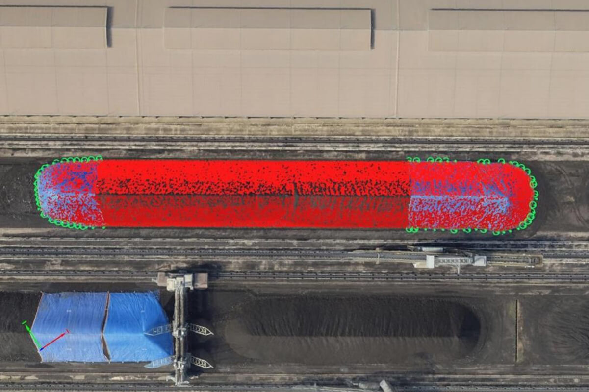
Volumetric Measurement
The accuracy of the 3D model
generated is more than sufficient to determine the volume of a specified area where the boundaries can be clearly identified. This new method can replace the traditional means of onsite surveys by achieving the same or better accuracy in determining the volume of stock piles, quarry or open pit mine measurements.
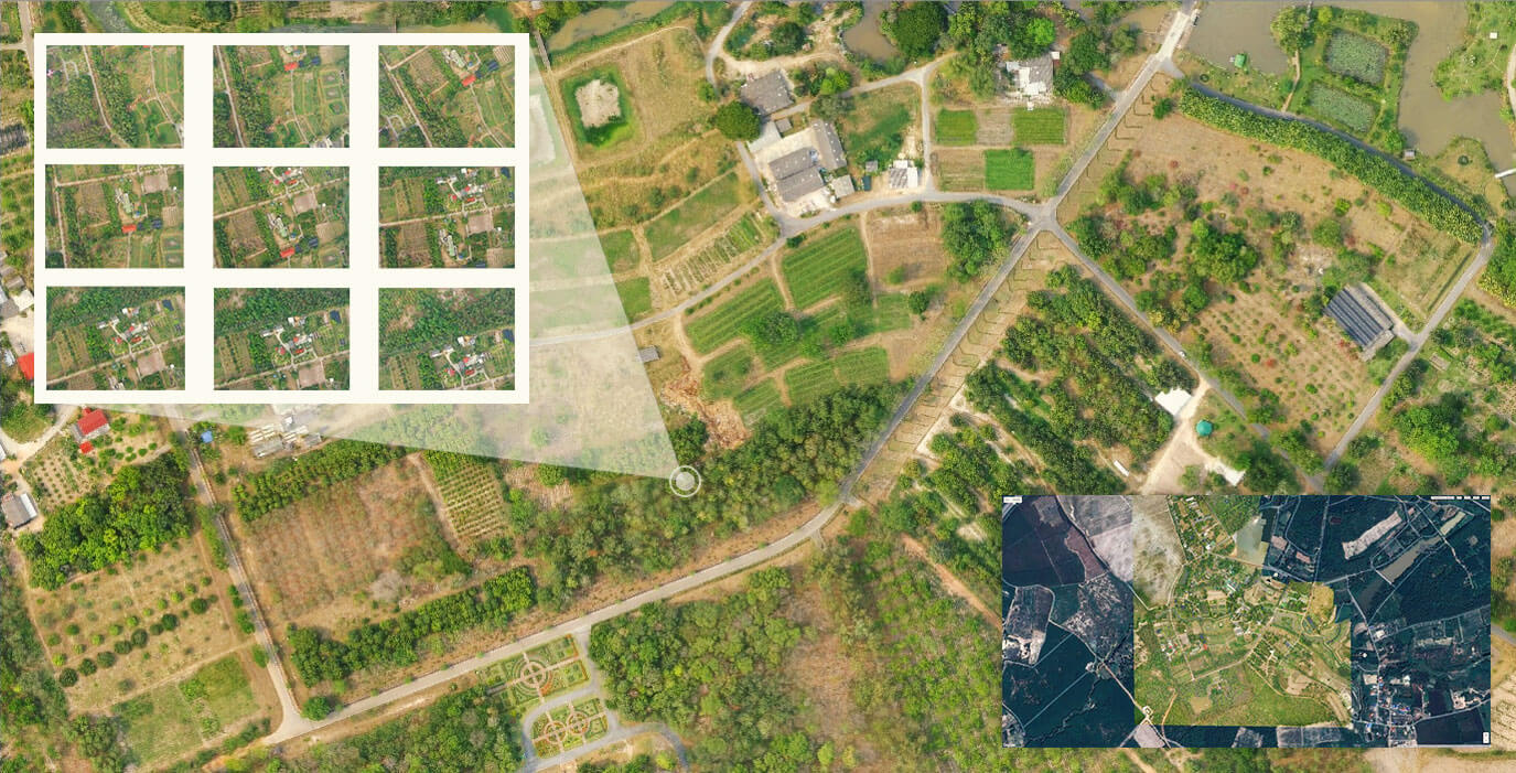
TRUE ORTHOMOSAIC
Our software will stitch together the hundreds of aerial images to compose a single image of the whole area under investigation.
The Latitude and Longitude of every point in the two dimensional picture will reflect closely
the real position on the ground.All measurements on the computer screen are up to scale with the actual measurements at the site.
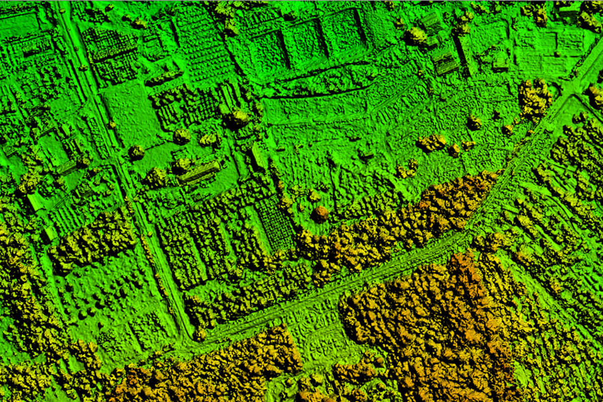
DIGITAL SURFACE MODEL (DSM)
he model depicts the elevation of all the surfaces from a bird’s eye view by using false coloring to show the heights of each and every surface from tree tops, roof tops, grounds, pits, lake and pond surfaces, etc.
DIGITAL TERRAIN MODEL (DTM)
The software will take away all above ground elements, whether it be building structures, trees, etc. and leave only the ground level terrain showing the false coloring of different terrain elevations. These models are very helpful in water resource management projects, soil conservation study as well as soil erosion determination.
3D MODEL
The ability to reconstruct a 3D representation will help in the visualization of the whole area under investigation. It can also be used as inputs into other application software such as the simulation program for training rescue workers in disaster preparedness.
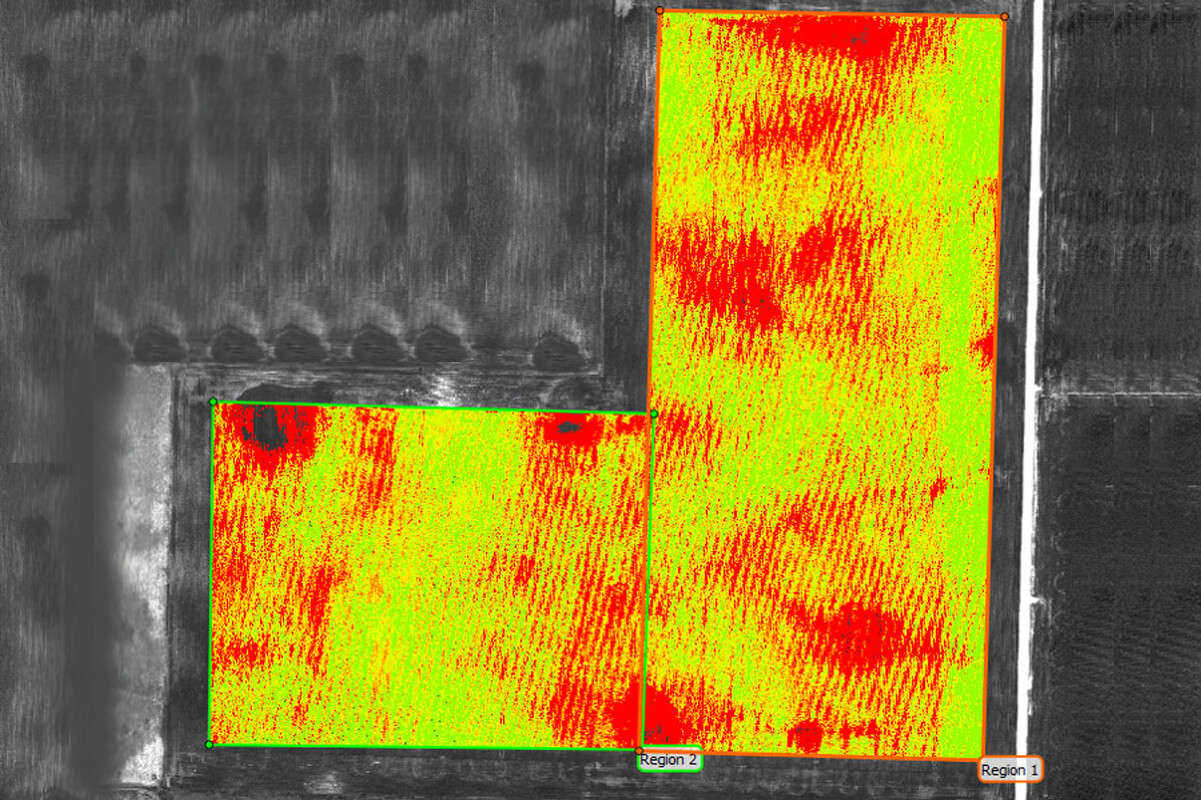
NORMALISED DIFFERENCE VEGETATION INDEX (NDVI) MAP
NDVI Maps are the tools used to determine “Plant Health”, images taken with a multispectral drone mounted camera once processed will generate an NDVI Map that identifies “stressed areas” within the plantation or field. This can be due to numerous reasons such as
lack of water, insufficient nutrients, plant disease, water logging,
poor irrigation, etc. Corrective actions can then betaken to remedy the particular situation to minimize the loss in yield. This constitutes what is today known as “Precision Agriculture”.
VOLUMETRIC MEASUREMENT
The accuracy of the 3D model generated is more than sufficient to determine the volume of a specified area where the boundaries can be clearly identified.This new method can replace the traditional means of onsite surveys by achieving the same or better accuracy in determining the volume of stock piles, quarry or open pit mine measurements.